GPS Map Camera Online vs Mobile Apps: Why No-App Tools Win in 2026
In 2026, the demand for visual verification on site reports, delivery logs, and travel documentation has reached an all-time high. For years, the only way to add GPS data to a photo was through bulky mobile applications. However, a major shift is occurring. Savvy professionals are ditching the App Store and Play Store in favor of the GPS Map Camera Online tool. But why is this "no-app" trend taking over? Let’s dive into the deep comparison between browser-side tools and traditional native apps.
Table of Contents
The Comparison: Online Tool vs. Mobile App
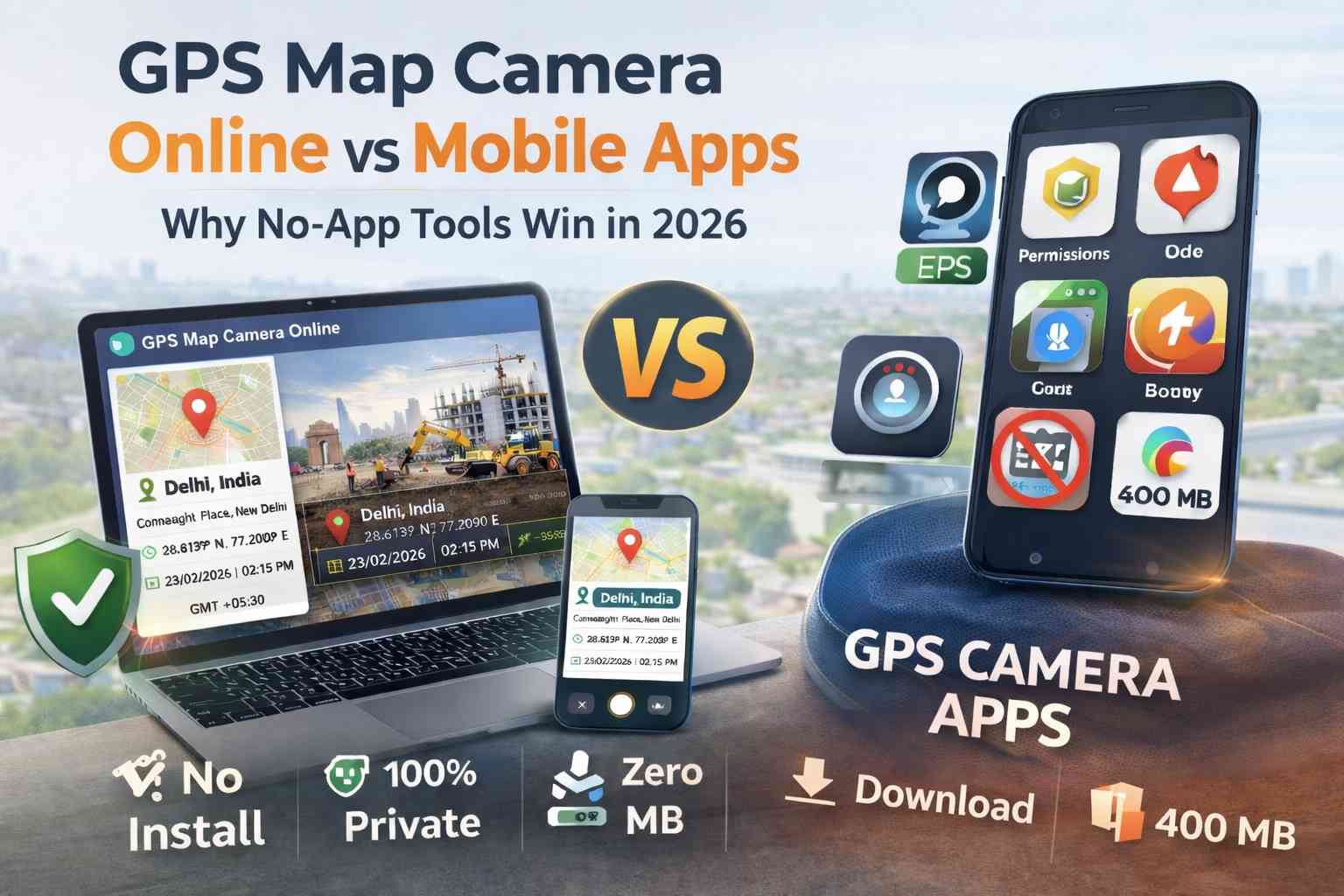
When comparing these two methods, we looked at key metrics that matter to field workers, engineers, and casual travelers. The results show a clear leaning toward web-based utilities for modern workflows.
| Feature | GPS Map Camera Online | Mobile Store Apps |
|---|---|---|
| Installation | None (Instant Access) | Required Download |
| Privacy | 100% Local Processing | Data Collection Common |
| Storage | Zero MB Usage | 150MB - 400MB |
| Account | No Sign-up Needed | Often Required |
| Updates | Always Latest Version | Manual App Updates |
| Battery Consumption | Low (Standard Browser) | High (Background GPS) |
| Ads Experience | Clean & Non-Intrusive | Frequent Popup Ads |
🚀 1. Speed & The "Zero-Install" Advantage
In the field, time is money. Imagine a delivery agent or a site inspector who needs to document a point of interest immediately. With a mobile app, they have to open the store, wait for a 200MB download, grant five different system permissions, and potentially create an account. This can take 5 to 10 minutes depending on the connection.
Using an online GPS map camera removes this friction entirely. You simply visit the URL, and you are ready to shoot. This "Zero-Install" architecture is perfect for temporary teams, subcontractors, or anyone who needs to capture a geotagged photo once and doesn't want another icon cluttering their home screen.
🔐 2. Privacy: Why Browsers Are Safer
Native apps often request "Always On" location permissions. This means the app developer could potentially track your movements even when the app is closed. For many users, this is a significant privacy violation. In contrast, browser-based tools only have access to your GPS coordinates while the tab is open and you have explicitly granted permission.
Furthermore, we process photos locally to protect your data. Unlike many free apps that upload your images to a central server for "processing" (and potentially data mining), our tool keeps everything on your device. For those looking to add location to photos without EXIF tracking, our browser tool provides a clean break from hidden metadata harvesting.
🔋 3. Storage, Battery, and Device Longevity
Modern mobile apps are "heavy." They consume hundreds of megabytes of storage and often run background processes that drain battery life. If you are working in the field all day, battery management is critical. Browser-based tools are "stateless." They use the existing optimized resources of Chrome or Safari, which are highly tuned for battery efficiency.
By using a web tool, you keep your phone's storage free for actual photos and videos, rather than wasting it on application code that you might only use once a week.
🌍 4. Cross-Platform Consistency
A major pain point for companies is the difference between the iOS and Android versions of the same app. One might have a feature the other lacks, leading to inconsistent reports. A GPS camera without app download is universal. Whether your team is using an iPhone 15, a budget Android tablet, or a Windows laptop in the office, the interface and the output remain 100% identical.
🏆 Final Verdict
While native apps might offer specialized offline mapping features, for 95% of users—including site inspectors, travelers, and delivery agents—GPS Map Camera Online is the superior choice. It offers unmatched speed, superior privacy, and zero impact on your device's storage.
Frequently Asked Questions
Ready to upgrade to a faster workflow?
Stop waiting for downloads. Start stamping professional location data onto your photos instantly in your browser.
Try GPS Map Camera Online Now